Route: ridewithgps.com/routes/46873101
Miles ridden: 106.8
Feet climbed: 3,419
Total time: 10:19
[NB: some photos courtesy Mel Embree and Chris Eisenberg]
Day 2 is the longest day of the ALC. I’ve split the recap into two parts, of which this is the second. The stats above relate to the entire day’s ride.
Salinas to Gonzales
We rolled slowly out of lunch from Salinas Central Park. In fact, this was another pattern we’d started, taking the first couple of miles after each rest stop easy to ease ourselves back into the grind of the ride. The remainder of our route through Salinas was unremarkable except to remark on its blandness. Too many signals to stop at, too many cars. There was nothing particularly difficult about this part of the ride, but nothing to recommend it either. Just a section you have to get through to get to the next one.
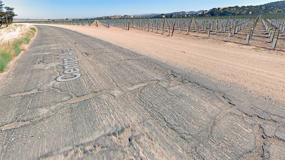
Which came soon enough. For reasons I cannot fathom, the route headed east out of Salinas before following the Salinas Valley southeast rather than skipping Salinas and its traffic and instead keeping southeast through Speckles and riding along the Salinas River on the aptly-named River Road . . . the road we’d end up westing to regain near Gonzales. These seemed like junk miles to me, empty miles for the sake of adding unnecessary distance to an already unreasonably long ride. But then again, it could be due to permitting issues or the convenience of the lunch spot some other force beyond our control. So we dutifully followed the route as we were told.
Once out of town and in the fields, it was very similar to riding in the fields around Davis. A lot of straight, flat roads. At the same time, it was better and worse.
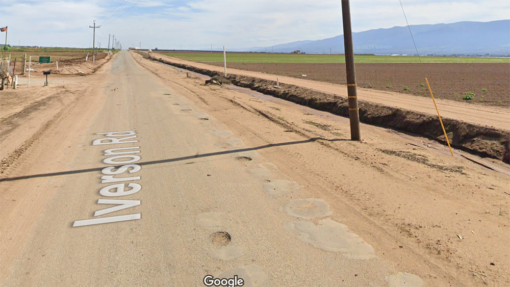
Worse in the sense that the pavement was very poor. Most of the traffic here is farm related, trucks, tractors, heavy machinery. The neglected pavement took a beating every day, and we got the worse of it. I mean, the pavement in Yolo County, where Davis sits, is pretty lousy. This was lousier. But to make it even more obnoxious, the gentle onshore breeze had piped up giving us a wonderful tailwind that could easily have pushed us well over twenty miles per hour with very little effort . . . if only the pavement would allow it. As it was, we had to temper our speed because we were constantly zig-zagging around potholes, broken, jagged edges, shoulders filled with drifting gravel and sand. Some people say this stretch is where they hit their highest speeds on the entire ride. But the person on the back of the tandem bears the brunt of the shocks of the road. That’s bad enough, and given Kathy’s back, we had to tread even lighter. Don’t get me wrong. I was happy for the tailwind. But it was a shame not to have been able to take full advantage.
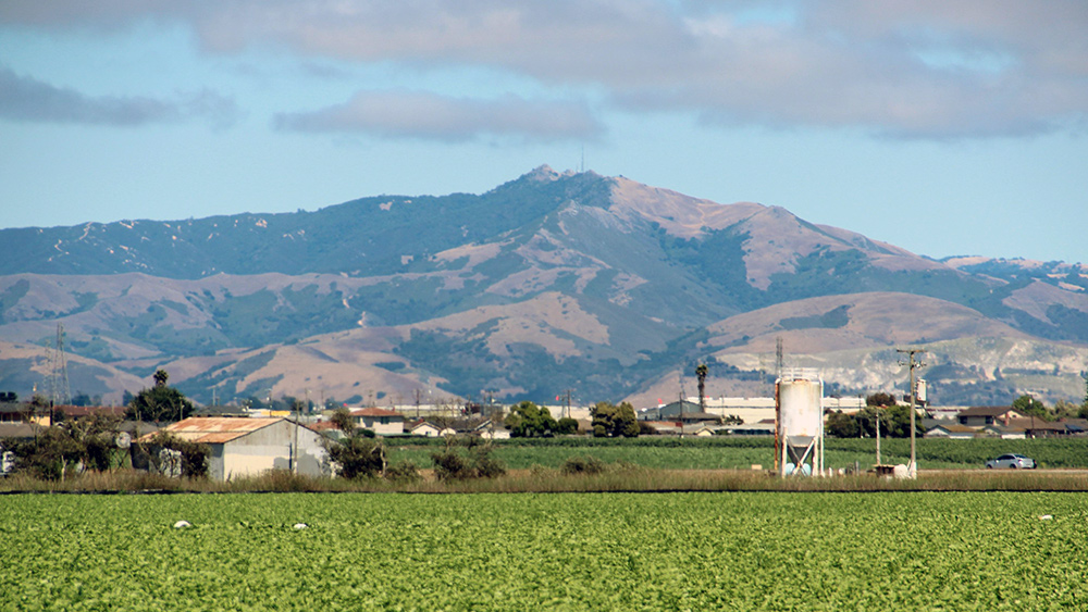
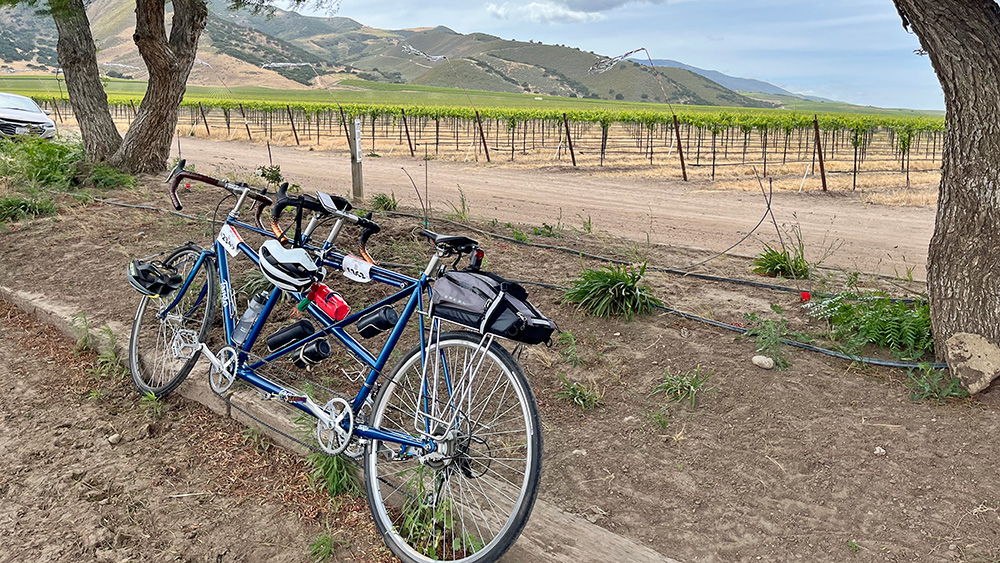
On the other hand, riding this stretch was better than riding around Davis in the sense that the surrounding land was more interesting. The Salinas Valley runs between the Gabilan Hills to the east and the Sierra de Salinas and Santa Lucia Mountains to the west. Thanks to the late-season rain, the hills flanking the valley still had green, not yet burned to their usual golden yellow. I would have enjoyed them more but for having to keep a close watch on the pavement. Still, I could steal a glance once in a while.
And there is history here. Not happy history, but part of the origin of Euro-American California. The Salinas Valley was the path of conquest and colonization of the California Indians by the Spanish. Gaspar de Portolà led the first Spanish land expedition through this valley in 1869. He was searching for Monterey and all he had for reference was a description from Vizcaino’s ship 165 years earlier. He reached the mouth of the Salinas River but never found Monterey. His expedition made it to San Francisco before they realized their mistake. The De Anza Expedition, arriving from the east, found its way up the valley in 1774.
More recently, John “The Pathfinder” Frémont antagonized the Mexican government in 1846 from atop Gabilan Peak (also known as Frémont Peak), which hovers over Salinas in the east. Frémont was a Captain in the U.S. Army Corps of Topographical Engineers. In 1846, he and his crew mounted the peak, which commands the inland approach from Monterey—clearly an offensive move on Frémont’s part even though Mexico and the U.S. weren’t at war. General José Castro ordered Frémont and his men to leave California. Instead, Frémont built a crude stockade and raised an American flag above the peak. Accounts vary, but it appears that after a few days his fellow travelers became bored and started to abandon the post. One night the makeshift flagpole blew over and Frémont escaped from the peak. It was interesting, as we rode along, to try to picture a time when there was so little here that you could spot a tiny flag on a nearby peak from the valley floor, and likewise be able to watch troops approaching in the valley below. Far more interesting than focusing on the dusty farmlands surrounding us as we pedaled by.
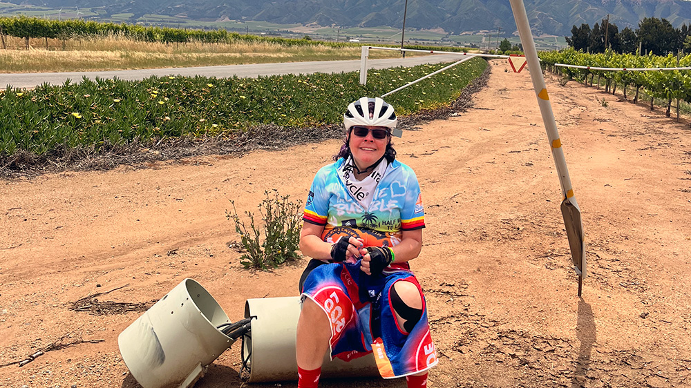
There were no towns along the route, nowhere pleasant to rest. ALC set up a porta-potty stop in a wind-blown dirt lot about eighteen miles down the road. We stopped there for a break. After pulling onto the dirt shoulder we rolled into deeper gravel and our front tire dug in. Not a crisis, but Kathy, who cannot see the road under the front tire, was caught by surprise. She dropped her left foot down bracing for a crash, which further hurt her already inflamed back. After we parked the bike nearby, she got off the bike and found a place to sit to give it a chance to rest.
I should clarify. Kathy’s back hurt because she was riding, but it was actually fine when she was pedaling. So she wasn’t sitting to rest her back from riding, but rather sitting because she absolutely couldn’t stand or walk once we got off the bike. As she remarked, “Cruel and ironic.” And as long as I’m clarifying, it wasn’t actually her back exactly that was inflamed, but her sacroiliac (SI) joint that was super inflamed.
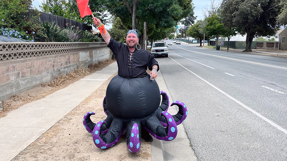
In any case, after the stop, we soon came to the turn that would take us back west toward Gonzales. We stopped at a Starbucks just shy of the rest stop so I could get some espresso to fortify me for the last 30+ miles of the ride. I also brought out a large cupful of ice to put in our drinks. A few minutes later, we were at Rest stop 3 in Central Park, Gonzales. The rest stop theme was “Pirates.” We were greeting by a giant octopus. Inside another pirate/rest stop worker was being tied to a flag pole. I’m not sure what that represented, but all seemed to be having fun. Kathy sat. I grabbed some snacks and refilled her bottles. The wind was howling now, making the rest stop less than an ideal place to hang out. Soon enough we were back on the road for the final stretch to our destination at King City.
Gonzales to Mission La Soledad
We rolled slowly out of the rest stop, crossed the Salinas River a few miles further on, then turned southeast to follow the Salinas River on River Road. This was the original route of Highway 101 in California. At the time it was built in the early 1900s it was designated Highway 2: Highway 1 ran from San Francisco to the Oregon Border; Highway Two ran from San Francisco to San Diego. The road was built west of the river through this area to keep out of the way of the agricultural fields. As a result, River Road follows the course of the river along the skirts of the Sierra de Salinas. For a cyclist, that means the road is not dead flat like the last section along the center of the valley floor, but instead frequently rises and drops with corresponding climbs and descents. It also means we enjoyed the occasional patch of shade, a welcome relief now that the temperature had reached the upper-80s.
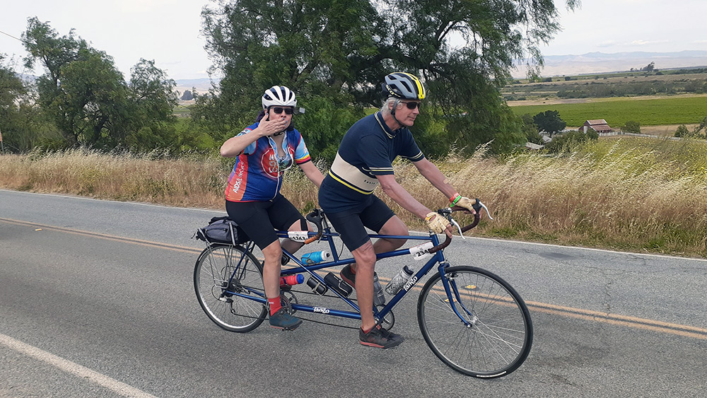
We had a lovely ride through this stretch. The wind was fully behind us. The pavement was better for the most part. We took it easy on the climbs and were often able to let the bike roll freely down the hills. It often happened that we would repeatedly pass and be passed by many of the same riders in the course of a day, and this area was no exception. A single bike, well ridden, can keep a good pace. Many of the riders on the ALC don’t maintain such a steady pace. Also, the much larger mass of the tandem means we often often slowed more and accelerated more than other bikes. And a rider’s position in the pack varies based on how long they spend at any given rest stop. People were gracious about being passed and having to swing out to pass us again. It often gave us a chance to visit, however briefly.
Usually passing riders were simply polite and informative: “On your left.” Some complimented us on taking on the challenge of the ALC on a tandem. Sometimes we’d hear something like, “That’s so cute!” The comments we heard most often, however, were some variation on how tandems are tough on relationships. I’ve used the terms before, but as a reminder, things like “relationship accelerator” and “divorcicycle.” Kathy’s standard quip was that “We’re both happily married to other people, and we’ve known each other forty years, so no problem.” Other times we might say something different. I might say, for instance, “I’m looking for a new partner if you’re interested.” To which Kathy might add, “So am I!” Most often we had fun with it. But I do have to say that after a while the negative implications grew a little tiring. I suppose not many people figured out that we were peppered with similar comments all day long.
There was one other tandem on the ride. I never compared notes with those riders about the comments they received, but I have to believe they were similar. Another thing that happened is every day it seemed someone would tell Kathy and me that the couple on the other tandem were not getting along, that they were fighting, that they were abandoning the ride. Nevertheless every time I saw them, which was usually before and after a ride, they were getting along fine. They’s been together ten years and were now engaged, and from what I could tell, they worked through whatever temporary issues arose between them just as Kathy and I had to. I think there was some schadenfreude involved, some desire on the part of other cyclists to to enjoy the pain of those who had to work out their issues on the bike. I really have no idea, but either way it was a little off-putting.
Also off-putting to me was riders’ insistence on using the word “rider,” quite redundantly in my opinion. A rider would be passing on our left and would call out, “On your left, Rider,” or sometimes, in our case, “Riders.” To which Kathy would often respond, “Thank you, Rider.” Now, there was only one type of person who could hear a passing rider say “On your left,” and that was another rider. So why add “rider?” It irked me in the way TV shows do when chefs say “Thank you, Chef.” It just seems so self-aggrandizing.
Then again, being irked by small shit like that is a sure sign that (A) I’ve had too much espresso, or (B) time for another shot.
Mission La Soledad to King City
Mission Soledad sat about twelve miles south of the rest stop in Gonzales. I’d stopped in on my scouting drive and noted that in addition to restrooms and water, the inside of the adobe mission and gift shop building was wonderfully cool. I thought it would make a great breaking point for Kathy and me. But when we pulled in we found it was closed on Mondays, a detail I had failed to note. So we sat on a wall in the shade for a while to allow Kathy to rest her back and me to water some nearby olive trees.
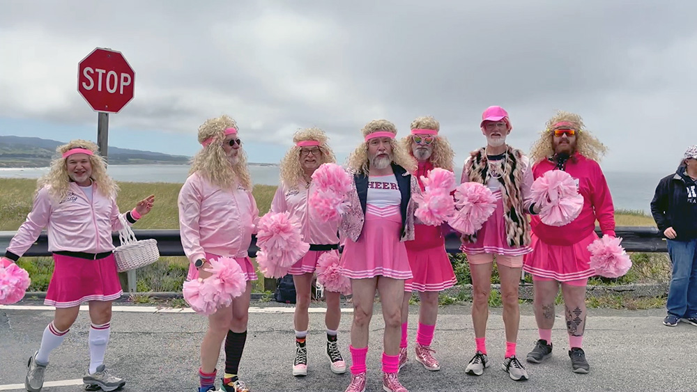
Another eight miles further on we came to an interim rest stop known as the Otter Pop stop. For those (like me) who don’t know, Otter Pop is something of a double entendre. “Bears” are big hairy gay guys. “Otters” are young bears. They could also be guys who dig bears. The Otter Pop stop features a bear dance party. The funny thing is that this stop used to take place at Mission La Soledad. I’m not sure if the mission folks were offended. All I know is this year it was moved further down the road.
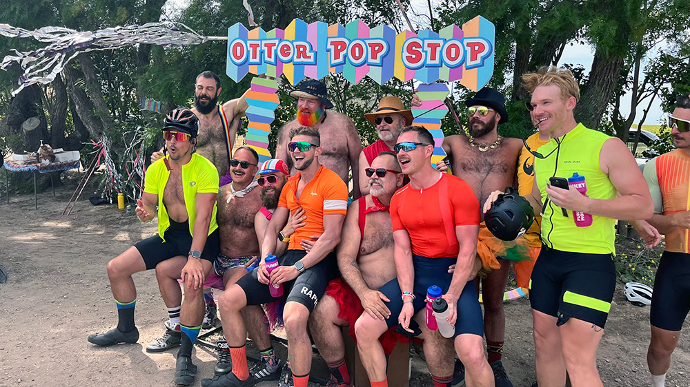
Kathy loves this stop, and I had to agree. The wind was fierce, but the outfits were outrageous, the mood jubilant. Kathy found a seat in the shade and I found an Otter Pop for her. WE hung out a while just enjoying the vibe. One of the phenomena people talk about is the Love Bubble of the ALC. Charlie, a rider Kathy and Came to know through training rides in the Bay Area, told us it’s the one week of the year he feels like he doesn’t have to watch his back. There is something wonderful about being in an atmosphere where an entire community feels safe just to relax.
Our breaks were more becoming more frequent; closer together and slightly longer each time. But under the circumstances I don’t know if we could have finished otherwise. I pushed when I could so we could get in as early as possible and give Kathy the maximum time to recover before our ride the next day. But I could only push so hard. What good would it do to worry about the next day if we didn’t finish this one?
Break over, we resumed. The next two miles were dead downwind on a slight downgrade with good pavement. We fucking flew through this stretch with very little effort, passing bike after bike after bike. Tandem heaven. The course turned off the main road to cross the Arroyo Seco River. This is a traditional spot for many to take a break and skinny dip. We passed. Not that we would have joined anyway, but I’d heard there were leeches in the water. No word on whether that’s true.
We climbed out of the Arroyo Seco on a steepish climb and worked around some canyon walls. The road turned east, then northeast, so were now fighting a fierce crosswind forward of the beam, making the ride more challenging. Another thing a tandem does well is move upwind because you have the power of two riders but the wind resistance of only one. The riding was still hard, but we were able to keep a good pace without wearing ourselves out as much as we would have otherwise.
We came to an intersection near Greenfield. Rest Stop 4 was straight down the road one mile further; King City and the camp and relief from the saddle were to the right. Without hesitation, we turned right, feeling bad about missing Rest Stop 4, but glad not to have to pay the price of two crosswind miles to enjoy it.
More tailwinds, more downhill riding, until we came to a point where we had to get on 101 for a couple of more miles. Plenty of shoulder and a rumble strip, but still . . . it’s just never fun riding a bike alongside traffic moving at 70 miles per hour. We exited the freeway on the outskirts of King City and rode for a mile or so on what is likely the worst pavement of the entire route. So unrideable that we swerved off the road to take the gravel path alongside an agricultural field. Offroad Tango!
We recrossed the Salinas River on a long, narrow, mixed-use bridge and finally, 10.5 hours after we started that morning, were done. Kathy could barely walk, and unfortunately, Roger had had to park quite a distance away so that was quite a slog for her. I had quite the walk myself from bike parking into the tent city. Then the usual chores of picking up gear, setting up the tent, etc. By the time I was done with dinner it was dark. No bike maintenance that day. Everyone was looking forward to Day 3 when we would ride “only” 65 miles. After riding 190 the past two days it did sound like a break. I just hoped Kathy would get enough time to recuperate. After all, we still had five days to go.

As someone who enjoys both challenges and scenic routes on my bike tours, riding from Salinas to Gonzales was a mixed bag for me. Initially slogging through town had its frustrations; there were definitely too many cars and traffic lights draining my enthusiasm before even hitting the open road! But once I escaped the urban sprawl, I began appreciating the quieter flat roads surrounded by farmland.