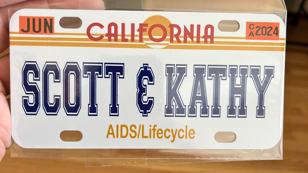
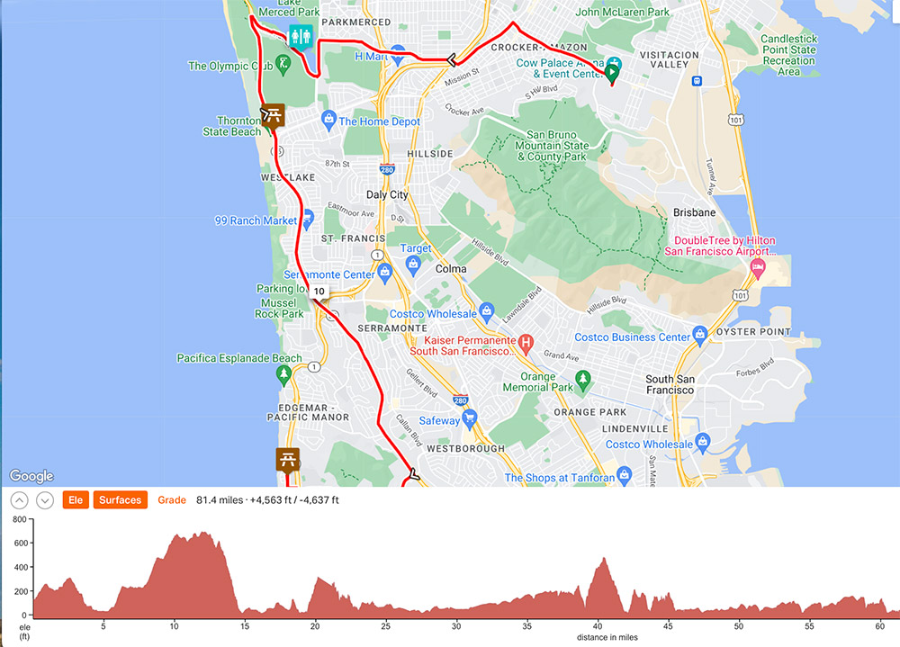
Route: ridewithgps.com/routes/46872340
Miles ridden: 78.5
Feet climbed: 4,245
Total time: 7:35
[NB: some photos courtesy Mel Embree]
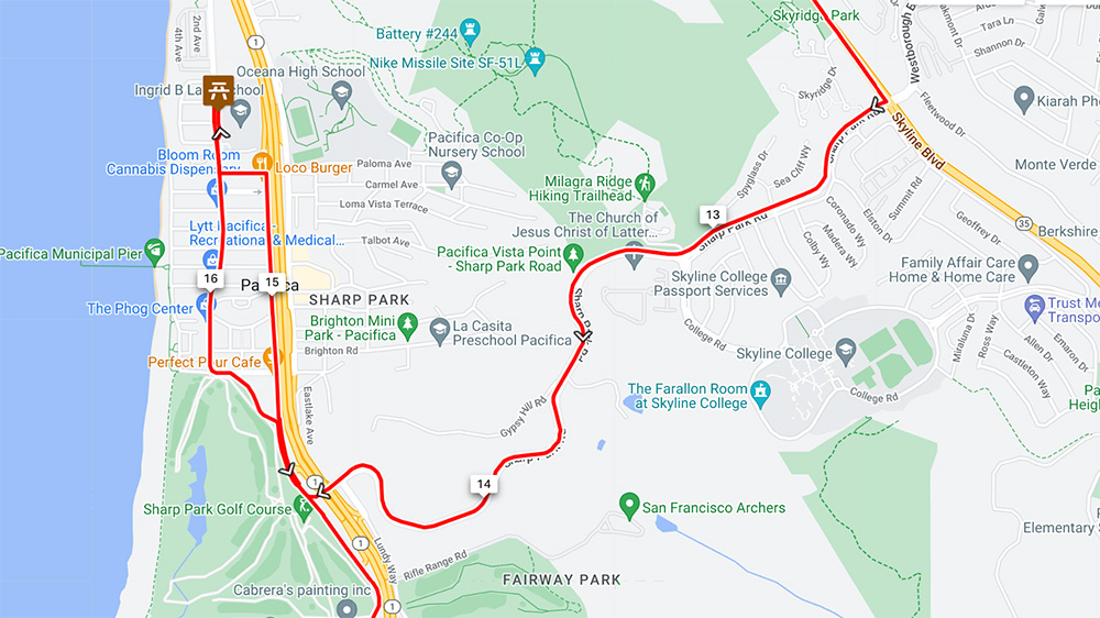
Cow Palace to Sharp Peak Road
I went into the first day of the ride with low expectations. Everything I’d heard from everyone told me the ride was chaotic and accident-prone from the start through lunch, which was 40 miles away at San Gregorio State Beach. Plus, we woke to a very windy, wet morning. There’s something about inclement weather that somehow adds to a rider’s anxiety. Maybe it’s the uncertainty of how the weather will develop, whether it will get better or worse. Or maybe the uncertainty of the surface you’ll be riding on, how slippery it might be, what hazards the water has put in your path. Unsettled weather is unsettling.
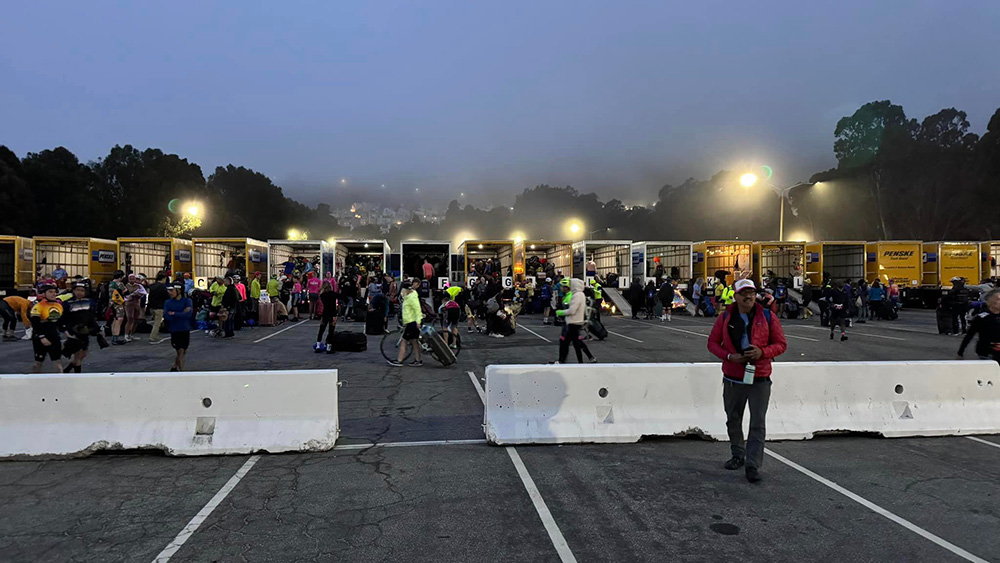
Either way, things started out poorly even before we got on the bike. They were serving light breakfast in the Cow Palace (oatmeal, pastries, coffee), and I needed some before we took off. The hall was crowded, loud. As we moved through it, Kathy stopped here and there to greet people she knew. But I was on a mission, so I ditched her. I got my breakfast, but when we reconnected, she was not happy. She told me she’d tweaked her already tweaked back trying to catch up to me. Bad move on my part, and not a good way to start.
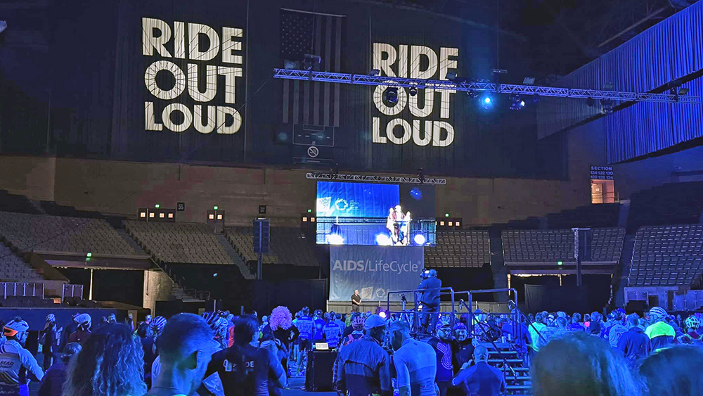
There were opening ceremonies inside the main area of the Cow Palace, but I missed them, preferring instead to check on the bike and get it ready for our departure. By the time I was finished, so were the ceremonies. Kathy and I found each other and prepared to leave.
Now, leaving the Cow Palace on Day 1 is its own type of cycling hell. A lot of people disgorge through a fairly wide aperture onto the mean streets of Daly City in a pretty short period of time. The street is blocked off, thank god, but it’s still crazy. We had preferred parking in the Positive Peddlers section. That enabled us to exit through a special lane off to the side, so we didn’t have to wait thirty-plus minutes or more to get started (which has happened to Kathy in the past). That boded well for making good time that day. But it was still nuts. Especially on a tandem. We’d practiced close quarters maneuvering quite a bit. We were pretty adept at slowing to a crawl and still keeping our balance. But with all the bikes surrounding us, it was still a little nerve wracking.
Once out and rolling, things opened up a bit. Five miles later we were starting the long pull up Skyline Drive to cross the hills and drop down to Pacifica and the coast.
Our strategy—well, Kathy’s strategy, which I think made a lot of sense—was to look for a pocket: that is, a space where we could ride comfortably with no bikes too close either in front or behind. Pockets, however, are ephemeral things. As an older bike, our tandem does not have the range of gearing modern bikes have. Mostly in the low end. That means we had to ride faster uphill than we might have wanted, because to ride any slower would have meant being unable to push the pedals, which of course meant we’d stall. Caught in irons, one might say. For those of you old enough to remember Laugh-In, picture Arte Johnson keeling over on his tricycle. that would be us.
Due to the higher gears, we had no choice but to pass slower riders who had lower gears. At the same time, faster riders who’d been land locked behind us at the start would sometime pass. Our climb up the hill was a constant search for a pocket, passing others to find a new pocket, and letting others go around us to maintain our pocket.
All in all the climb wasn’t bad. Sure it was breezy, and sure I had to wipe the mist off my glasses every 30 seconds or so. But no weirdness. No one stopped in front of us unexpectedly—which happens more often than you might think—and no one passed us so closely we worried they were going to clip our front wheel. And for all the wind and water, the long, slow climb warmed us up nicely.
Sharp Peak Road to Half Moon Bay
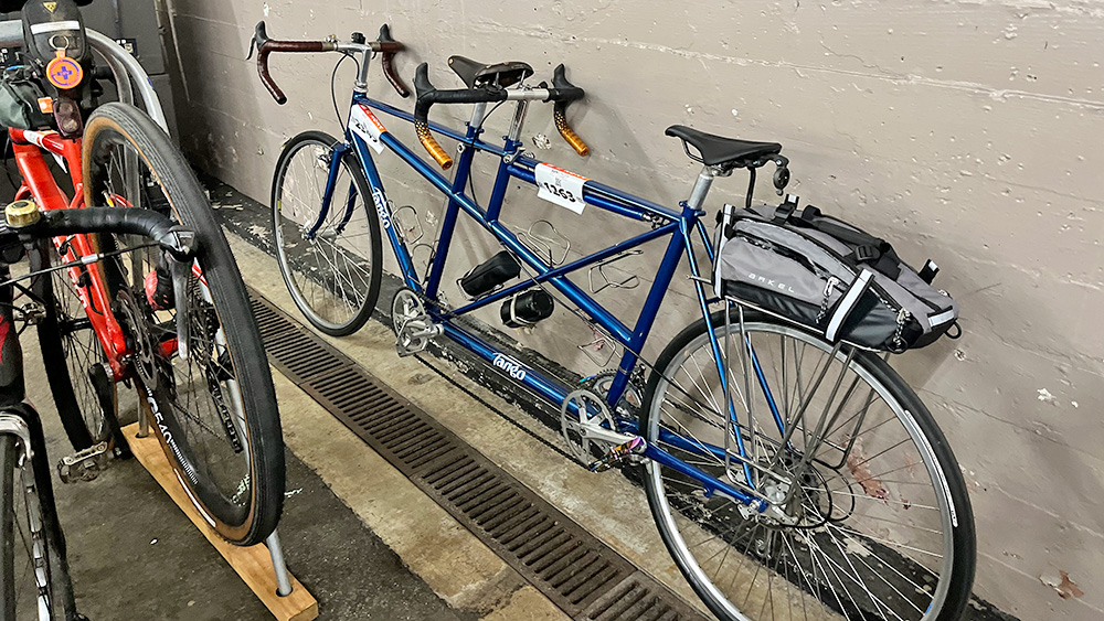
Once at the top, we had a long, wet descent, complete with eucalyptus leaves and other slippery things. The Tango predates hydraulic disc brakes, so we have rim brakes (cantilever in front, roller cam in back), which require a fair amount of force to squeeze. There is also the added variable of how well they will grab wet rims. Given the weight of the tandem itself, plus two riders, a gear trunk on the back rack, and seven bottle cages filled with water, tools, spare parts, and sundry other items, our tandem generates an incredible amount of momentum on a downhill. As Rick puts it, “mg sin 𝛳” or “MG sine Theta.” Which is to say, “Mass times Gravity times Sine of the slope,” the variable between us and other cyclists being Mass, of which we had a surfeit. Short version: tandems fly down hills.
Happily, the Tango is equipped with a drag break. It’s sort of like a handbrake on a car. The drag brake regulates our speed. It won’t stop us on a steep descent, especially once we’ve started accelerating, but it slows us enough to allow me the freedom of not having to apply brakes throughout the entire descent. It also greatly relieves Kathy’s anxiety level. Every time she clicked the drag brake on full she commented on how much of a relief it was. At first, I thought that was a funny thing for her to say, because it didn’t affect what she had to do one bit. Over time I realized she was talking about a more internal kind of relief.
Anyway, descent started, drag brake on, we did what we do on hills: find a pocket. A few riders sped past at excessive speed, but again, didn’t pester us. We reached the bottom somewhat colder than we’d left the top, but really, pretty relaxed.
At this point we had a decision to make. Rest Stop 1 was one mile to our right—the wrong direction (see map inset above). And by all reports, Rest Stop 1 on Day 1 was one of the most crowded and chaotic of the rest stops on the ride. Quick check to make sure we were doing okay on water and provisions. All good, we turned left.
From there to Half Moon Bay we enjoyed a nice, albeit hilly ride. Still doing well, we passed interim restrooms and water-refilling opportunities I had mapped. We crawled up the hill to Devils Slide and coasted swiftly through the long dry tunnel that bypasses the old road. I think it was somewhere in this stretch that we coined a mantra for our ride: “We’re just taking a long, leisurely ride in the country.” This phrase came to mind whenever we were riding smoothly along. Kind of a way of saying to ourselves that we could enjoy moments of relative ease while pedaling our hearts out all day long.
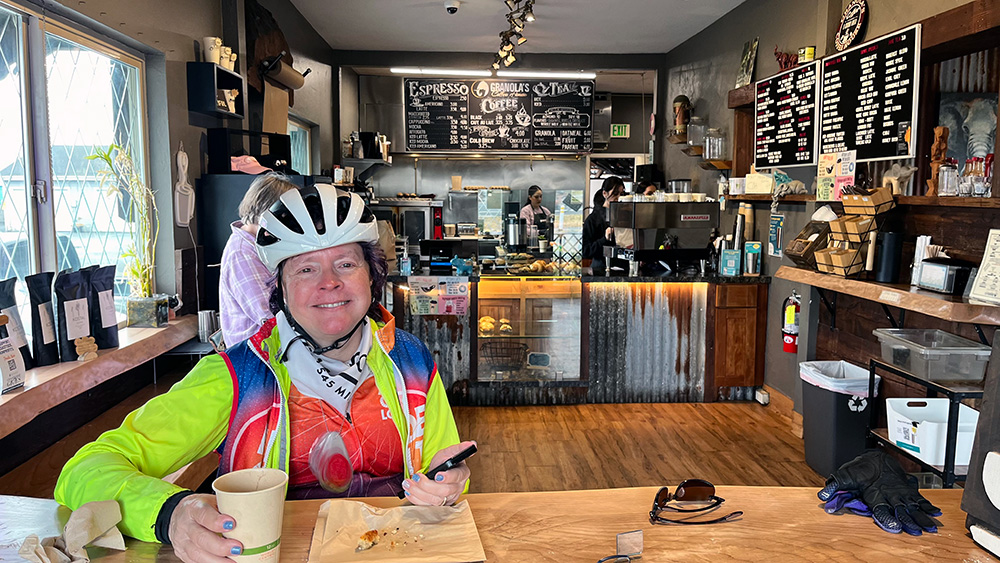
Just before Half Moon Bay we pulled over at a coffee house with the improbable name of Granola’s Coffee House. Rest Stop 2 was less than a mile ahead. But we’d ridden nearly 30 miles to that point and this was our last chance for me to refuel on coffee, so we pulled in.
It’s worth noting here that the ALC has a lot of rules and protocols. I mean, a lot! One if them is that the organizers strongly discourage deviating from the course for any reason. They say they are concerned about keeping track of all the riders, that it could violate permit restrictions, and that other rides might follow and get lost. All stuff I don’t really care about. But Kathy does. As a result, when scouting the route I kept my extracurricular coffee/food/restroom deviations to those within sight of the route, and always on the right-hand side of the road. Granola’s Coffee House fit both of those criteria.
Once inside, I ordered a double espresso to save time (instead of sipping, say, a cafe americano) and a really good looking chocolate-blueberry scone. When Kathy got out of the restroom, she devoured her half of the scone, which I might add was still warm from the oven. I thought we’d be ready to roll. Bur once that warm bliss hit Kathy’s stomach, she asked if I’d mind if she got a hot chocolate. To which I thought, “Hell yes I mind! We’re making time here. We need to get going!” But then I thought the better of it. Here we were, warm and cozy in this cafe after thirty miles of wind, wet, and cold. What was this situation if not a perfect part of a long, leisurely ride in the country? So I quashed my desire to power on. Kathy got her hot chocolate and another scone because they were just that good. Soon enough, we were back on the road.
And as it turned out, better off for the break. Because when we rolled by Rest Stop 2, it looked as crowded and crazy as any rest stop I’d ever seen. We’d managed to warm our bodies and our tummies, sit down and take a very relaxing break indoors, and use a real rest room rather than a porta-potty, all with no lines. We noted our good fortune at stopping earlier and rolled on.
Half Moon Bay to Santa Cruz
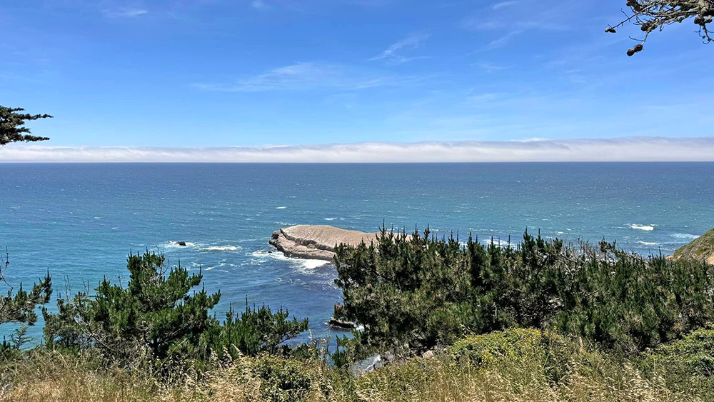
Once through Half Moon Bay there wasn’t another traffic signal or stop sign until the outskirts of Santa Cruz, some 40 or 50 miles away. This is a glorious section of coast, and if you’ve never seen it, do yourself a favor and check it out. There is a brief passage in A Heartbreaking Work of Staggering Genius written about the area around Half Moon Bay that reads:
“. . . then the cliffs before Seaside—then flat for a little while, then a few more bends and can you see this motherfucking sky? I mean, have you fucking been to California?”
That pretty much sums up all of this section of the coast.
I went to school at UC Santa Cruz, as did Kathy. I have no idea how many times I drove up and down this coast during those years. But I do recall one trip. At some point before Kathy and I knew each other, a group of us, including our mutual friend Glenn Berkovitz whom Kathy was dating, caravaned up to San Francisco to get sushi. Sushi hadn’t yet become a thing, and there was none in Santa Cruz. I remember seeing Kathy and Glenn riding along in the back of an El Camino all the way up and back. Maybe not an epic memory, but being on the coast does take me back to those late-70s days.
And in a sense, that’s how this stretch of the ride went. By skipping the first two rest stops we were well near the front of the entire pack. That meant fewer riders to have to watch out for, smaller lines at the rest stops, more time to look around and enjoy the view and trade memories of our time here.
We stopped near Pigeon Point lighthouse at an unofficial rest stop and were greeted by a group of men dressed as cheerleaders. Their cheer was, “Pedal faster bitches.” Not much on rhyme, but hilarious nonetheless. Check it out:
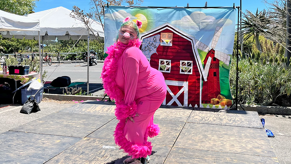
When we rolled in to Santa Cruz, there was a rest just four miles before the finish. It seemed pointless to take a break so close to the end, but we were tired and Kathy’s back hurt, so why not? Rest stops on the ride all have a theme, which changes daily. The theme for Rest Stop 4 on Day 1 was “Pigs.” All workers were in costume, and some in character. We were serenaded by Miss Piggy, which was its own kind of entertainment.
From there we rolled slowly to the finish, taking our time because we had so much of it, pointing out landmarks from our Santa Cruz days: Ferrell’s donuts, the house on Van Ness, the surf break at Cowell’s, the theaters where Kathy worked as a projectionist . . . Soon enough, we crossed a small hill into Harvey West Park, and just like that, the first day’s ride was done.
Harvey West Park
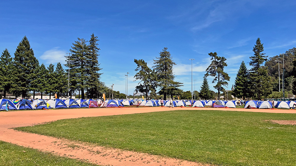
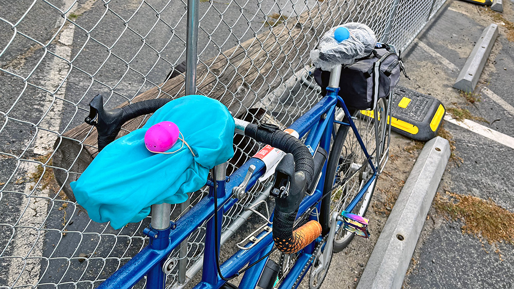
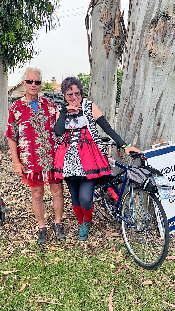
Kathy’s husband, Roger, had to scramble to meet us at the camp because we got in so much earlier than Kathy did when riding alone. They went off to their hotel while I stumbled through the logistics of life in camp. I learned on the fly that every rider is given a number (A-52 in my case). On Day 1 you are assigned a tent which you tag so you use the same one every day. The camping area is laid out in a grid, so you camp in the same designated spot every day. Mobile showers are on this end of the park, the dining area on that. Medical tents here, electronic recharging tent there, etc., etc. Once I had my bearings and my gear stowed inside my tent, I went back to the bike to clean and lube it and make sure it was ready for the next day. I put shower-cap seat covers on the saddles so they’d be dry in the morning and considered the tandem put to bed for the night. Lights out for me was 9 pm. I’d been up and moving since 4:30 am, and I had a hard time staying up that late.
After our shaky start, we’d had a perfect first day. We’d ridden 82 miles in less than 8 hours, as good as we could expect, especially with Kathy’s ailing back. My main concern had been getting in early enough for Kathy to have as much time as possible to rest up for Day 2, the longest day of the ride. The course was 110 miles, an all-day grind even under the best circumstances. The temperature in the Salinas Valley, where we’d ride most of the afternoon, was forecast in the 90s. We’d need all the rest and relaxation we could get to make that run.